

Learning about Topographic Maps
Teaching topographic maps might seem daunting, but it’s an incredible way to help kids connect with the world around them—literally! Who knew learning topographic maps could be so hands-on?
With just some playdough and a little creativity, your kids can explore contour lines and elevations like never before. This simple, engaging activity turns abstract map skills into a tactile experience they’ll love. Whether they’re building mountains or tracing valleys, it’s the perfect way to bring geography to life—one squishy layer at a time!
NOTE: This article was written by Heather, the previous owner of Only Passionate Curiosity.
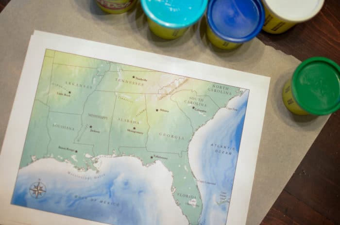
We’re planning on road tripping from DC to our new home, so I brought out my trusty WonderMaps from Bright Ideas Press to explore more with the kids. Working with maps has always been something I love- there are a million different ways to map places and adventures, so I printed off a couple different maps for the kids to look at.
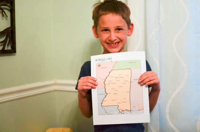
First, we checked out the political map and Doodle discovered the neighboring states. He’s THRILLED that Florida is *right there* and we’ll be close enough to finally visit Disney World. He’s also pretty excited about New Orleans because we’ve watched the Princess and the Frog about a million times.
I had him trace the border of the state with a marker, and we practiced writing Mississippi at the top of the page.
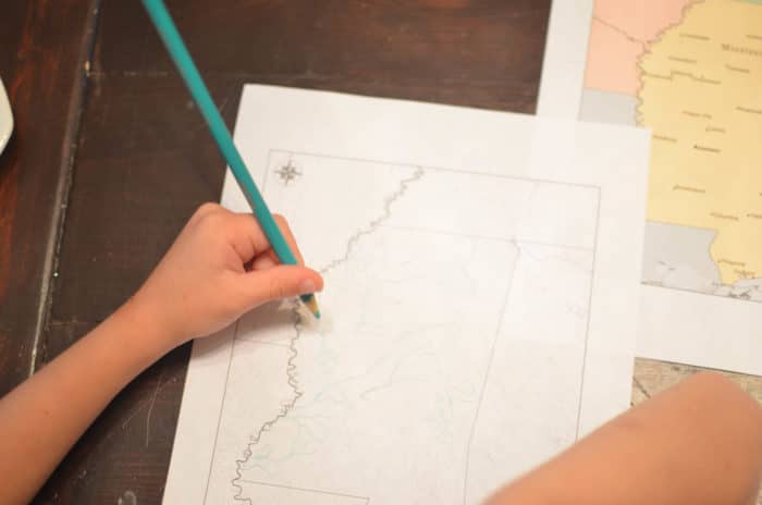
We wanted to learn more about Mississippi’s rivers, once Bug pointed out that Tom Sawyer and Huckleberry Finn explored the Mississippi River. It turns out that the state is FULL of rivers, which thrills the kids. We all love the water (true San Diego babies at heart). Doodle traced all the river in the state using a colored pencil on a black and white map.
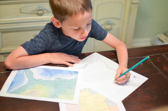
Finally, we looked at topographic maps of the region. Topographic maps left the kids feeling a little bit stumped- they understood that the differences in colors indicated a change, but it was hard to explain depth and elevation to Doodle and Little Miss.
The concept was just a little foreign to them- not the idea that lakes and oceans get deeper and deeper and mountains are high- but that you can show elevation through color changes on paper – the topographic map aspect.
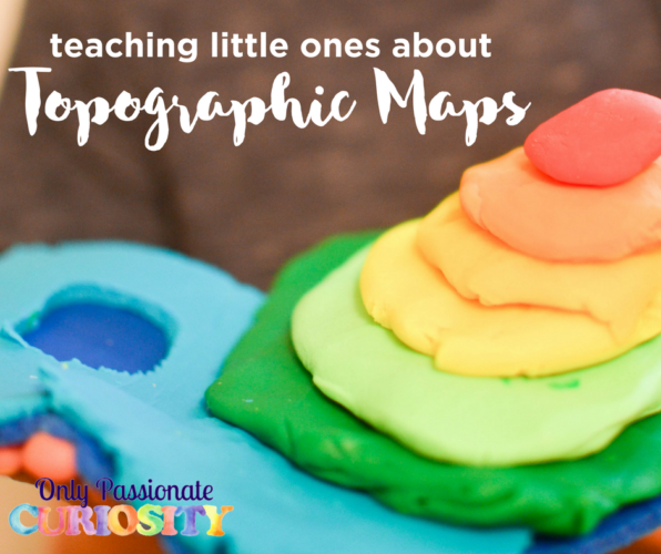
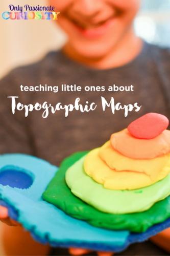
Teach Topographic Maps with Playdough
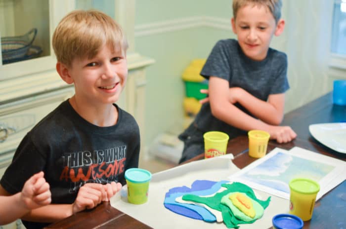
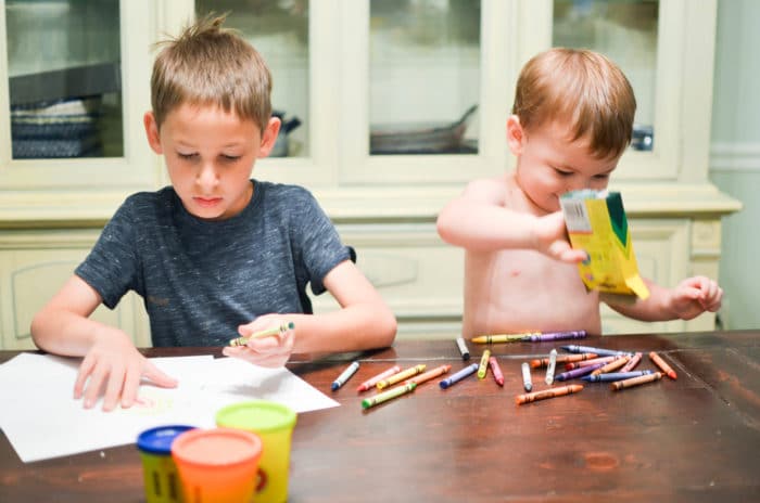
I wanted to take this concept and help them see it and feel it, so out came our playdough! Bug, our oldest, decided he wanted to try and build an elevation map of the South, and Doodle decided he would just try to make a lake and a mountain with his playdough.
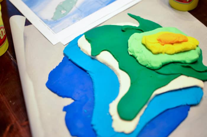
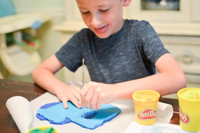
Using a WonderMap as a guide, Bug first laid out dark blue to represent the deepest parts of the ocean, and then layered more colors on top to show the landscape. He used clay tools to help him cut the playdough into more precise shapes.
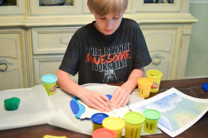
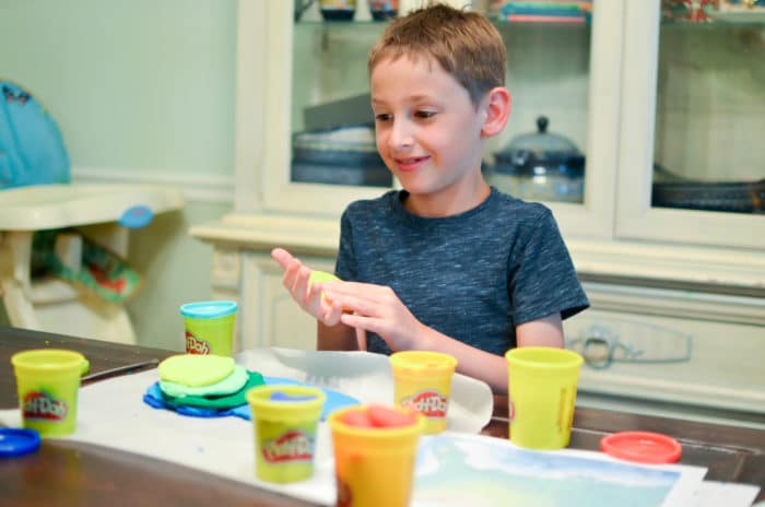
After watching Bug’s technique (and being lectured by his older brother on just how to lay the playdough in layers), Doodle gave it a try. He worked hard to get his dough nice and smooth and then he stacked it up.
Both boys were very careful to not squish the playdough down too hard- they understand that there is nothing that makes Mama cringe more than the playdough colors being mixed together!
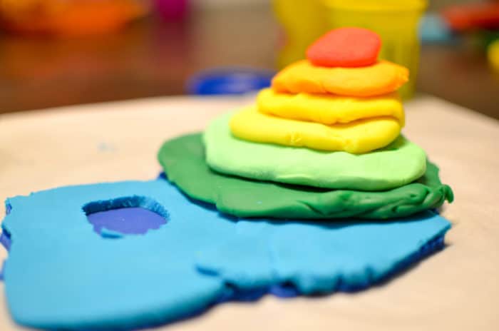
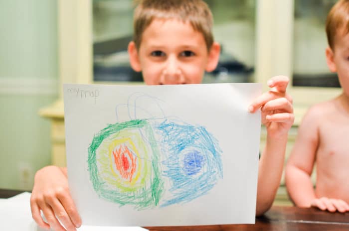
After we built these clay topographic maps, I had Doodle map out his creation so he could see how he could show elevation with colors and lines. I think putting it back on paper after building a 3D model was important for cementing this concept for him.
You May Also Like:
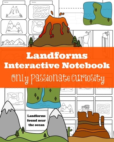
Landforms Interactive Notebook

Curriculum-Free Geography? How to Get It Done and Have Fun!
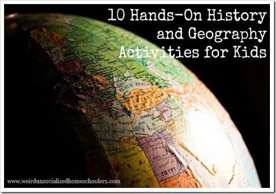
10 Hands-on History and Geography Activities for Kids
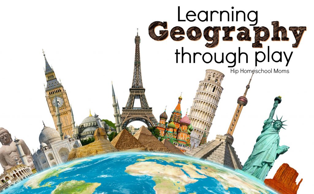
Learning Geography Through Play


We live in Alabama. Thank you for the chance!
We live in FL. Thank you for offering this. its a huge blessing
We live in Georgia.
Missouri
We call Pennsylvania, United States of America our home state and country.
Illinois
Colorado!
We live in Florida.
We are a TX family! Thanks for offering this opportunity. Would love these maps! 🙂
We are a military family too, so right now we are calling North Carolina home.
I live in North Carolina! We are excited to explore more with maps this year!
Florida grown from birth. I live where I vacation!! ?
We are in Georgia!
I live in Tennessee but I call Pennsylvania home!
Indiana!
Wisconsin
Michigan
we call nevada home. nice and hot and no snow just the way I like it.
WE live in the state of Colorado.
New York is home.
Marion
We live in California…but Montana is the home of my heart!
We call the state of Texas our home! 🙂
We live in Wisconsin.
Pennsylvania
Beautiful northern Minnesota!
Nevada
Northern BC, Canada!
Sunny California!
Texas is the state I call home now, but I was born in New York. 🙂
We live in the Empire State~ New York (not in NYC but upstate in the Adirondacks)!
Maine
Ontario, Canada
Indonesia
Ohio!
Massachusetts
The Green Mountain State – The 14th Star – Vermont
Tennessee ?
Arkansas, USA
Canada
This looks awesome!
New Mexico
Ohio, USA
FLORIDA!!
I’ve been drooling over WonderMaps for awhile. Would love to win!
Iowa
Pennsylvania USA
Colorado, USA
I’ve been in Minnesota for 29 years but spent my first 18 in Wisconsin and still say I am from WI! 🙂
Washington State (not to be confused with Washington DC).
Texas!
South Carolina!
Indiana
North Dakota
FLORIDA
Alabama!!!
Michigan
Georgia!
Illinois
Montana
Florida
This one is from OHIO!
We live in Texas!
Missouri is home, but we live in Virginia!
We live in Maine and are increasing our map/geography studies this home-school year. WonderMaps would be perfect!
We live in Pennsylvania!!! I’m doing a map skills class at co-op this Fall, cannot wait to try this idea with the kiddos! Thanks so much! 🙂
California!
Utah
We are in Texas!
Virginia
Colorado!
North Carolina
Michigan!
Virginia
This looks incredibly helpful to teach upper elementary homeschool children World Geography
Virginia
Ontario, Canada
Georgia USA 🙂
Minnesota
Texas
The big, beautiful Texas!
Arizona
Florida
California
Arizona!
Wyoming
Washington
North Carolina at present
Tennessee
The Lone Star Stste, Texas, is where we hang our hats! 🙂
Texas, currently travelling the great Rocky Mountains.
Florida, but I claim North Carolina as home
Louisiana!
South Dakota, USA!
Minnesota
Colorful Colorado!!!
We are in Oregon.
Missouri!
I live in Kentucky!
We are in Massachusetts
Mexico
Pennsylvania, this looks like a great teaching tool!
We live in PA USA!
Tennessee is here!!!
Michigan!!!!
I live in Delaware!
We’re in Pennsylvania. Looking forward to doing the clay maps w/my kiddos! Thanks for the great idea!
I live in Indiana.